


Hiking up Mount Washburn
- Meredith
- Jul 10, 2017
- 4 min read
Mount Washburn, for all you naïve folk (I kid, I hadn’t heard of it until a year ago or so), is located in Yellowstone National Park in Wyoming. Elevation at the top is 10,243 ft. above sea level. There are two trail options to get to the top – 1) Dunraven Pass, which is the trail from the south, at about 6.2 miles round trip through a more forested area (BEARS!!), or (2), Chittendon Road, which is actually a seldom used NPS service road, and is about 5.1 miles round trip but climbs at a steeper rate. At the top is a lookout area that actually has a 360 degree building at the top that a park employee spends the summer in scouting out wild fires that may have started.

So now that I’ve brought ya’ll up to date on the factuals, I’ll get to my personal experience. Randy and I decided to hike up the Chittendon Road trail on June 30th, which turned out to be a perfect day for Mt. Washburn. Because of the elevation, the top tends to be windy and chilly in nature, but Yellowstone also has these “afternoon rollers” – thunderstorms that happen basically every afternoon. Guess that happens over giant volcanoes.. But anyways, June 30th was perfect! No clouds in the sky when we started around 1pm, and all through the afternoon it was sunny and clear skies.
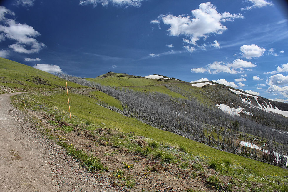
Randy and I had bought a “Hiking in Yellowstone” book as well as a map that covers all four areas of the park – Southeast/west and Northeast/west – which we used to help plan what hikes to do and the topography of the hikes. As a former Indian Guide, Randy assured me that he knows how to read a topography map and is an excellent scout. So we start out on the trailhead, which is just a short, steep trail to the actual trail up the mountain. So anyways, he reads the map, and assures me that after this steep part the trail “sort of just level out.” So here I am thinking the hardest part is happening now and will be over in a minute. Well, we get to the actual road that’s used as the trail, and we see it looping far up the mountain, and Randy says, “….I may have read the map wrong.” Yeah, he did. It’s literally a trail up a mountain. The steep part is not over in the first five minutes. So for anyone looking for an easy trail, don’t go to Mt. Washburn. I mean, we knew it was up a mountain so we were prepared, he just didn’t register that his map reading made no sense.
The hike up the mountain is gorgeous. The trail is known for its immense collection of wildflowers, and there are a few times going up when you have a pretty awesome 180 degree view. Don’t be afraid to stop though and rest.. when we got to this point I felt about as dead as these trees and we still had another mile to go up.

Also, the book told us that there would be a drinking fountain at the top. Lies!! At least, it was not in service when we got up there, because it was nonexistent. We had just finished our water, confident we’d be refilling before we headed back down, and then we couldn’t find any sort of drinking fountain. It was probably the most let down we’ve ever been.. But at least the hard part is the way up – I couldn’t imagine going up without water.
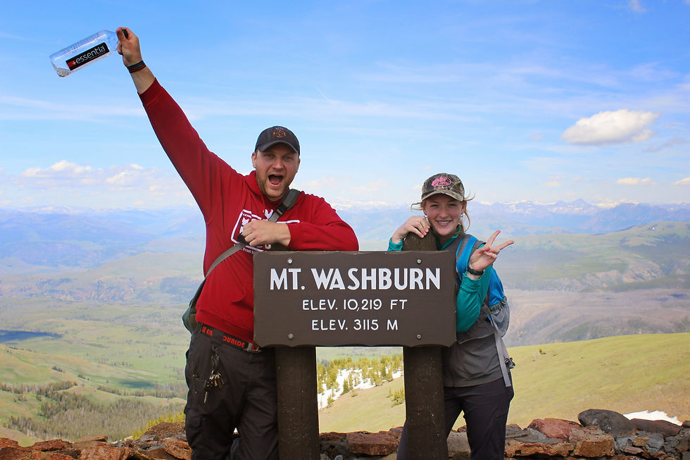
The view from the top is incredible. It is a full 360 degrees, and both our trail and the Dunraven Pass trail meet up at the top. You can see the Grand Tetons 70 miles to the south, the Grand Canyon of the Yellowstone, and all around the north, east, and west part of the park. When you get to the top, it’s really hard to think about any problems you’re having because everything seems so insignificant and small when you’re up there. You literally rise above your problems. I think maybe Congress should move their Capitol Hill to the top of Mount Washburn. But that’s just me.
The hike down is just as great as the hike up. The only qualm I had was figuring out where to shift my weight to so that I didn’t feel like I was walking like a pregnant troll (waddling with my stomach forward and my back leaning backwards) or feel like I was leaning forward and about to just fly down the mountain face forward. I can understand why people use walking sticks now.

The whole time on the mountain, by the way, you’re either stripping down or you’re frantically looking for your sweater. I started out cold at the bottom, since I hadn’t started moving yet and the breeze was kind of chilly, to taking all my sweaters/vest off, to putting my sweater back on, to putting my big sweater on, to back to just my shirt. I mean, if you’re worried about getting a good work out in, the hassle with the clothes is a pretty good one in and of itself.
All in all, I’m in my happy place here in Wyoming. After all our hiking that day, we drove back to the West Yellowstone Grizzly RV Park and grilled bison burgers. It’s always happy ends to happy days when you’re where you want to be.
~the mountains are always calling and I will always go~


Comments